Annapurna Circuit, Nepal
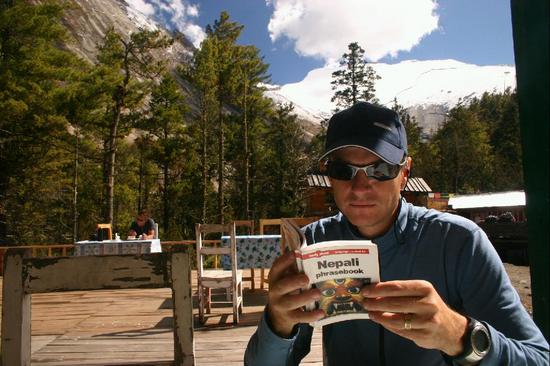
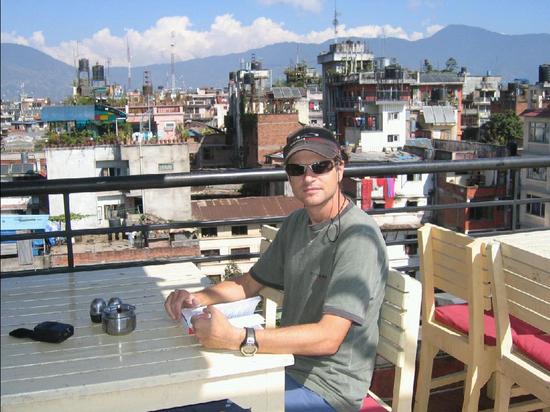
We hired an experienced gent named Krishna – a porter/guide from Asahi Treks and Expeditions – to help with translation and to carry our main pack. The peak altitude on the Annapurna Circuit trek is at 5416m which we expect will present some very good challenges… It’s a very well travelled route, and we will be finding food and shelter every night in tea houses etc. Not sure if able, but will try to send some updates from the trek (apparently there is a 5 star resort about 2 weeks in!)
Here’s a Rough map of the area from yetizone.com 
Post trip report…
The Annapurna Circuit was a spectacular trek that exceeded our expectations. We loved the challenge of seeing how our body would respond to the challenge of sleeping and trekking at high altitude. Although a popular route (the most popular in Nepal), I didn’t feel that it was commercial or overcrowded (except at Thorong La, where there’s only 2 guesthouses). It’s the most popular for a reason:
- Comfortable guesthouses spaced out so that you can go at your own pace – push hard or take your time.
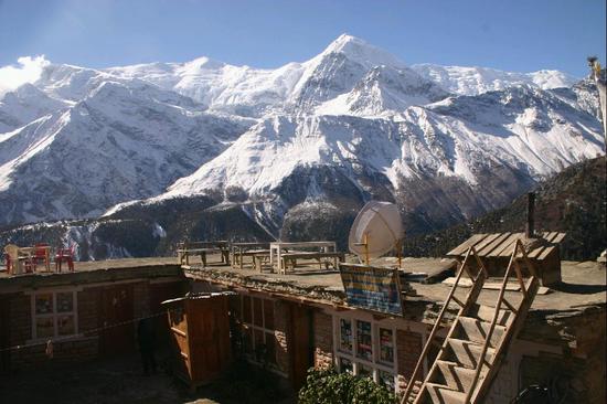
- A huge range of spectacular scenery – it felt like we were trekking through the seasons:
spring, summer, winter, spring, and summer again. - Opportunities for challenging day hikes, if and when you’re up for it.
- Our guide, Krishna, also helped to make this a memorable experience. He was very reliable, always making sure we had a good place to rest our head each night, and always ready in the morning with bells on.
Day 1
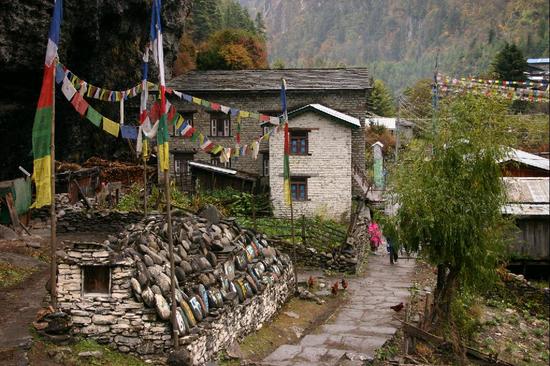
Most people spend their first night in Besisahar, but we were eager to get started, so we hiked in a couple of hours to Bhulebhule. Our first night was quite memorable for me, because it was the night that I learned that sleeping in “tea houses” did not mean having to lay a pad down on the dining room floor, or to sleep on a woven straw cot under a lean-to shack. The tea houses were really guest houses, with very basic sleeping facilities. Our room had 4 walls, a light, a window, and a lockable door, with two wooden bed frames topped with a thick foam pad and clean white linen. This was quite typical of all the rooms we slept in on the circuit (some more breezy than others). Our sleeping bags still came in handy as we got to higher altitudes and needed the extra warmth. The quality and freshness of the food was a nice surprise too. It sure beats freeze-dried beans and rice.
Days 2-3
The first few days were long and hot, with 6-7 hours of gradual up and down hiking, hovering around 800-1800m altitude. It was quite dishartening to find that after a full day of hiking, and despite the aching muscles, we would only have gained a couple hundred meters of elevation. We had a total of 4500 meters to climb to get to the pass, so we were eager to start gaining on some of that elevation. The scenery, however, made the long days well worth it. The lower elevations treated us to lush subtropical forest, hills covered in terraced fields of rice and millet, and villages dotted with banana and orange trees. It wasn’t until day 3 that we were able to catch glimpses of the dramatic rocky mountains with rivers cutting a deep gorge and waterfalls into them. It felt like I was being lured into the majestic Himalaya mountains, with just teasers of their massive size. On Days 2 and 3, we spent the night in Ghermu and Tal, respectively.
on Day 4: we experienced our first and only major rain fall of the entire trek, but it lasted less than an hour – just long enough for us to enjoy a morning tea in the shelter of a tea house. We were affraid that the rain would be a sign of snow in the pass (which would make it impassible) as the clouds further up the valley continued to hover over the pass ominously for a couple of days. By this point, teams of donkeys and many large groups of trekkers started to appear, and to vie with us for position on the trails. Temperatures had dropped low enough that we required warm layers at night, which made for much more pleasant hiking during the day. Due to the larger crowds competing for the better beds, and in respect for the more rapid altitude gains we achieving, we had to start cutting our days short. We spent the night in Danagu.
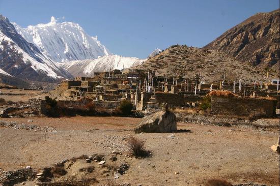
By Day 5, we were above 2500m, and the local villages had virtually vanished, with most buildings being there simply to house tourists and nomadic herders. The vegetation and scenery around here reminded me a lot of the rocky mountains in Canada. Despite the altitude, we were both feeling great, with no noticeable symptoms. To decrease our risk of AMS (Accute Mountain Sickness), which becomes a problem above 2500m, we started spending the afternoons doing day hikes to higher altitudes, before coming down for the night. We spent this chili night in Chame.
By day 6, we were hiking through highly aromatic coniferous forests, surrounded by massive, 7000-8000 meter high snow covered peaks and canyon-like rock faces, as we followed the river up the valley. We spent the night in lower Pisang, after a 200m acclimization hike up above upper Pisang.
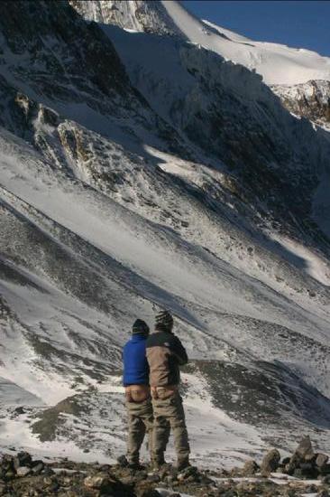
On day 7, we had to negotiate with our guide/porter to find a way for us to take the higher, more scenic route from Pisang to Manang. Naturally, with him carying our heavy pack, he wanted to take the flatter, easier route. We trusted him enough at that point, that we decided to send him along on his own, with our pack, to secure a room for us, while we took the longer route. This higher route took us up over 1000m, through the snow dusted towns of Ghyaru and Ngawal, and rewarded us with spectacular views of the Anapurna peaks. We even got to observe a couple of massive avalanches in these peaks, as we stopped to observe the grazing mountain sheep.
To further improve our odds against AMS, we spent one full day acclimitizing in Manang. After a much needed sleep-in and hot shower, we hiked up 500m to the Gangapurna Glacier Viewpoint, with beautiful views down to the Manag Valley.
On the 9th day, we hiked up to 4000m, to a tiny “village” of guesthouses called Yak Karka (which means Yak Pasture). Above 3000m, to avoid AMS, it’s recommended that you limit yourself to 500m of altitude gain per day. This particular day we were pushing the envelope a bit, with 720m of gain, and I was feeling it. The snow was staying on the ground now, air was feeling thin, and I was finding myselft short of breath. At bed time, I measured my resting heart rate to be 92 bpm!
Day 10 was our final day before the big push over the pass. It was a short 3 hour hike to Thorong Pedi, with an elevation gain of 450m. No one lives up at this level. Yak Karka is about as far up as the yak herders go. We spent the afternoon acclimitizing to the low oxygen levels by hiking 700m up to High Camp, for some spectacular views of the snow covered mountains all around us, and the hovering eagles above. This was the longest 700m of the whole trek. I had to walk very slowly, and stopped frequently (every minute or so as we approached the top) to catch my breath. At night, I don’t think my resting heart rate got below 100 bpm. Other than the shortness of breath, and the psyched out feeling I was getting from thinking about my rapid heart rate, I was feeling fine. Grant woke up with a bit of a headache, but after walking around, it went away. We were very fortunate. Some people had splitting headaches and had to rest another day or turn back. Some people went down to Manang and got air lifted out. Some people vomitted all night, and then opted to hire a donkey for a ride over the pass.
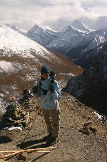
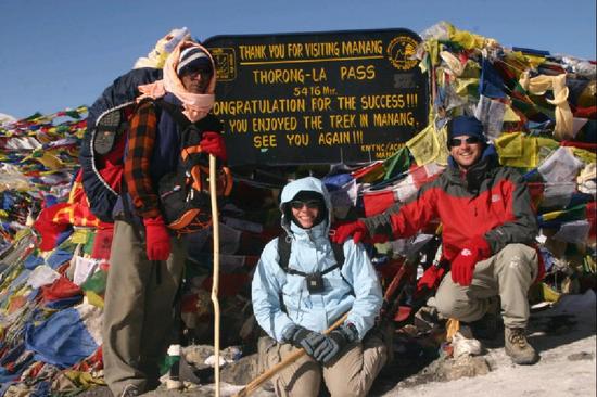
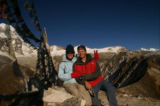
In the wee morning of Day 11, we rose along with at least 100 other trekkers, and began our half awake climb up Thorong La in the dark. With the adventure racing spirit that we just couldn’t shake, we passed dozens of people up the narrow switchbacks, quickly gaining the 30 minutes that we had lost by sleeping until 5:00. It was bloody cold out, with the snow crunching like styrofoam (suggesting the temp was sub -10 degrees C). The sun rose after about an hour of hiking, which is always a spectacular sight to see in the mountains. Even more spectacular was that the sun stayed bright all day, with not a cloud in the sky. We were very fortunate to reach the 5400+m pass on a clear sunny day, being rewarded with breathtaking views of the glaciers all around topped with a deep blue sky. Unfortunately, by the time we reached the top, after the most labored breathing and highest heart rate I had ever experienced, AMS had finely caught up with me, punishing me with a splitting headache that would last for the next 24 hours. I also managed to catch a cold that would turn into a sinus infection, and last a few weeks. But it was worth it.
While the hike up to Thorong La was very difficult, the hike down to Muktinath was down right scary. The back side of the pass was more in the shade, so the snow and ice covered the trail most of the way. The trail was narrow, and sloping downhill slightly as we tried to traverse the hill. One slippery step and we’d go tumbling down the steep slope. Luckily we had some hiking sticks to try to save us. We made it to Muktinath by 2:00, after over 8 hours of hiking, 1000m of ascent, and 1600m of descent. Legs were aching and devoid of strength.
Day 12 ought to have been a rest day, but we were eager to get back down to warmer temperatures, and less arid conditions. We hiked for 7 hours, through dusty, dry, windy air, along a rocky riverbed. With my sore throat, and stuffed up sinuses, the strong, dry blowing wind was hard to take, but a bandana over my face made it more bareable.
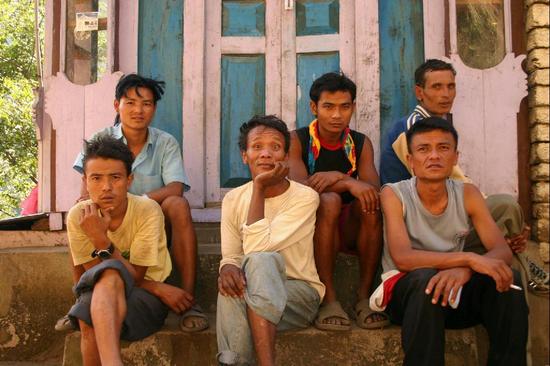
This half of the circuit is much more visited than the first half, due to the popularity of the “apple pie trail”, with more developed guesthouses, and an airport. The first symptom I noticed of the increased tourist traffic is increased begging from school children. Some children even start to get agressive, almost ordering you to give them money. Unfortunately many tourists still encourage this behaviour by responding with coins, school pens, or candy.
We spent the night in Marpha, gloriously sheltered from the wind, and surrounded by apple orchards. Marpha is known for its delicious sundried apples, processed with a more advanced process than simply laying them out in the sun. It’s also known for it’s delicious apple brandy, which reminded me of a pretty good tequila!
Day 13 was a pretty miserable day of hiking for both of us. Grant had eaten something that didn’t agree with him (we suspect he’s allergic to Dahl), while my feet and legs were killing me (blisters forming now from the downhill motion) and my sinuses were constantly running. But by the end of the day, we had made it back into the land of greenery: coniferous forests, lush vegetation and ferns, plots of vegetable gardens, and glorious waterfalls. It’s amazing how good water and plants look after you’ve been deprived of them for a few days. We spent the night in Ghasa, which is down around 2000m.
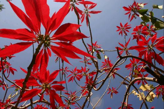
Day 14 was a much more enjoyable day, with only 4 1/2 hours of hiking and plenty of rest stops. I relished the sights of many lush green plants and vegetables, fuits, massive red poinsettias, cherry trees in full blossom, impressive waterfalls, and a narrow raging river. We wasted away the afternoon relaxing in the massive hotspring pools of Tatopany.
I finally got my much needed rest day on Day 15. A day of sleeping, relaxing in the hotsprings, reading, soaking in the hotsprings, eating, and more sleeping 🙂
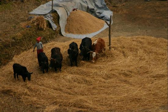
Day 16 we hiked up a thousand meters, up hundreds of steps, to Sikha. This Southern part of the loop is very lush, with rolling hills and views of the Annapurna peaks to the North. It’s also a lot more populated than other parts of the circuit. We passed children hiking a mile or so to go to school and women processing harvested grains and straw.
Day 17 was another day of many, many, many stone steps uphill, mostly through tropical forests filled with massive rhododendron trees (unfortunately not in bloom). We spent the night in chilli town of Ghorepani (back up at 2600m), which is perched on the North side of a hill, with awsome views of the peaks around us. This is where we met a super-athelete from Sweeden, who had followed the same route as us, carying her own pack, and made it to this point in 9 days! Wow, I’m humbled. She’s sure lucky she didn’t get AMS. Being athletic doesn’t increase your odds of avoiding AMS, if anything it leaves you worse off because you tend to gain altitude faster.
By the way, Annapurna View guest house makes the circuit’s best banana pancakes, I swear!
Day 18: We rose early to hike up 400m to the top of Poon Hill, to watch the sunrise over the peaks (Nilgiri, Annapurna South, Hiunchuli, Machhapuchihre). The hike to Tadopani was a beautiful walk over a ridge and up/down through a rainforest of moss covered rhododendron, maples, and coniferous trees. Views in the morning of the surrounding peaks were even more spectacular.
Day 19 was a easy walk down through shaded mossy forest, with many springs, streams, and waterfalls. It felt like the set of an ivory spring commercial. We camped out in Gandruk for the night, and then filled our afternoon with a day hike up another 500m to Khumrong, for good views back over Gandruk.
The final day, day 20, was all downhill. We passed many fillages and farms, and children playing away the weekend. Being back on the main “road”, we were passed again by many donkey trains. By noon, we boarded the public bus to Pokahara, marking the end of the circuit.